HOME> Expert Assessments>Hazards Outlook
For 3-7 day hazards see Weather Prediction Center's: WPC 3-7 Day Hazards
U.S. Week-2 Hazards Outlook - Made May 03, 2024 | About the Hazards Outlook
ATTENTION:
For more information on the addition of the experimental Rapid Onset Drought hazard type to the Climate Prediction Center's 8-14 Day Hazards Outlook (Contiguous U.S. and Alaska), please click HERE.
To provide feedback, please answer the SURVEY.
| Composite Map Day 8-14 |
Experimental Probabilistic Outlooks |
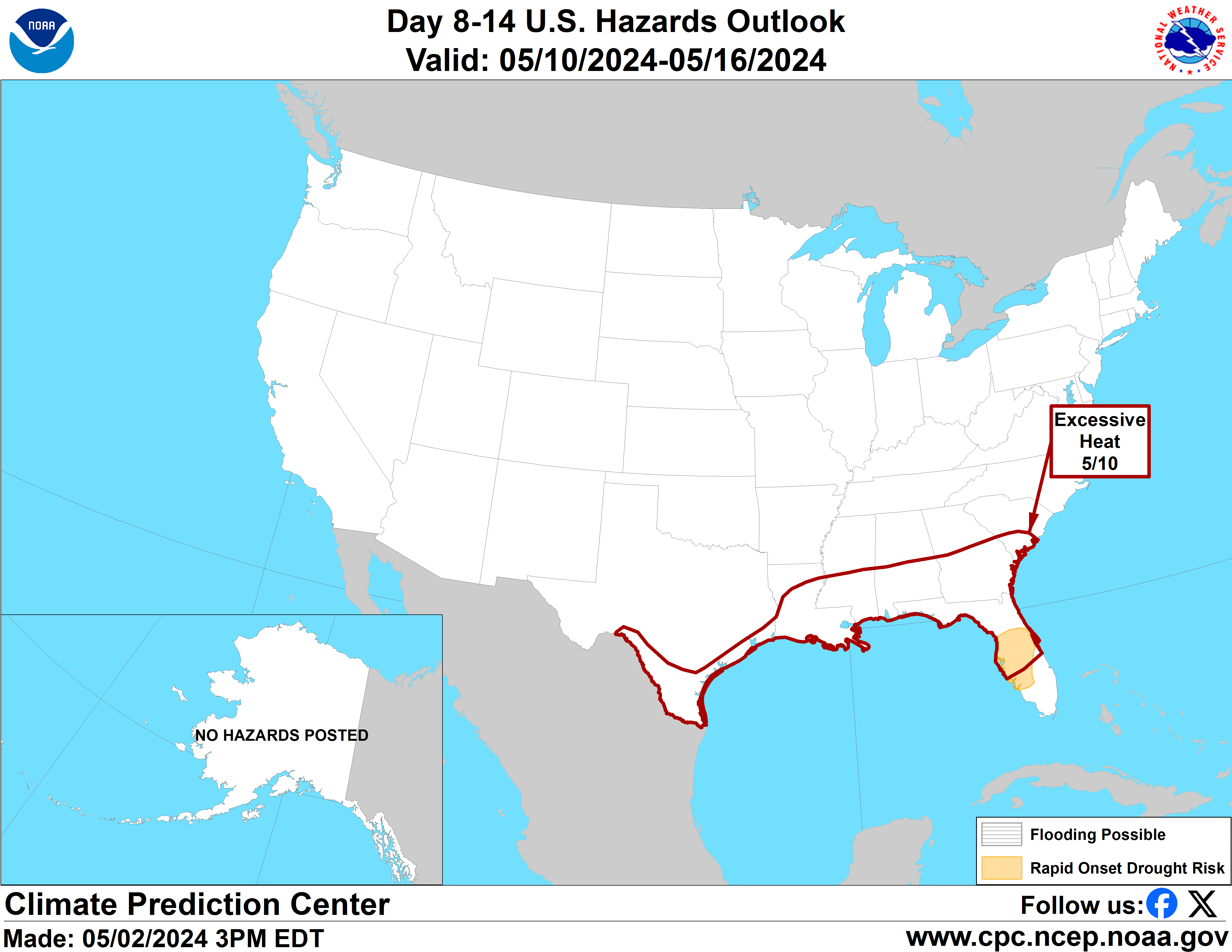 |
Valid Saturday May 11, 2024 to Friday May 17, 2024
US Hazards OutlookNWS Climate Prediction Center College Park MD
300 PM EDT May 03 2024
Synopsis: Mid-level high pressure over the West Coast and surface high pressure over the Great Plains results in a relatively tranquil period of weather for week-2. High temperatures and continued rainfall deficits lead to a risk for rapid onset drought (ROD) for portions of central Florida.
Hazards
- Rapid onset drought possible for portions of central Florida.
For Monday May 06 - Friday May 10: WPC Days 3-7 U.S. Hazards
For Saturday May 11 - Friday May 17: At the outset of week-2 ensemble models favor moderate ridging(troughing) over the West Coast(Great Lakes) as depicted by 500-hPa height anomalies. Model solutions dampen both features over the course of week-2, with weak positive height anomalies and mostly zonal flow over the contiguous U.S. (CONUS) by the end of the forecast period. At the surface, building high pressure is favored over the Great Plains, which will help to bring cooler temperatures for the southern CONUS. Positive height anomalies over the Pacific Northwest at the outset of the forecast period are favored to bring much warmer-than-normal temperatures to portions of Washington and Oregon, however these are not expected to exceed hazardous thresholds so no hazard is posted.
In Alaska, as we move into the middle of May snowmelt season is underway and frozen rivers are beginning to break up. This leads to the potential for river flooding related to ice-jams. We continue to monitor the situation but currently there are no indications of impending major river break-ups or serious threat of ice-jamming so no flooding-related hazards are posted at this time.
In Florida, above-normal temperatures and near- to below-normal precipitation is forecast during week-1 and into week-2. In parts of the central Florida peninsula soil moisture levels are declining due to limited precipitation in recent weeks and months. Abnormal dryness (D0) has been developing and expanding across this region. As we approach the middle of May, increasing sun angles and temperatures in the 80-90 Deg F could lead to further drying of soils and potentially lead to drought conditions across this region. Therefore, an area of rapid onset drought (ROD) is posted for portions of central Florida.
Forecaster: Danny Barandiaran
$$ Please consult local NWS Forecast Offices for short range forecasts and region-specific information.
Resources
Week-2 Probabilistic Extremes Tool
GFS Ensemble Forecasts